Finally, the ship is ready. Pytheas sets off for the edge of Europe
One spring morning, the small flotilla, led by Pytheas, cast off and left Lacydon. It headed straight for Ampurias, as did the Greek ships trading between Massalia and the small city they had founded over two hundred years ago.
Strabo tells us: "From Marseille to the Pillars of Hercules, Eratosthenes gives seven thousand stades, but starting from the Pyrenees six thousand..." (E13). Eratosthenes did not travel to the western Mediterranean. He therefore got this information from Pytheas, the only one to have provided it. If we count 157 meters (road stade) for the stade, this gives us 157 km for Ampurias, because this is the city in question for the Pyrenees. Ampurias is located in Catalonia, near Rozès. The distance is a little underestimated. In "Pythéas", Yvon Georgelin thinks that it could have been because of the Ligurian current which would have pushed the flotilla. This current, with a speed of movement towards the west and the south of 45 km per day, allows us, in fact, to find the real distance: 210 km
.
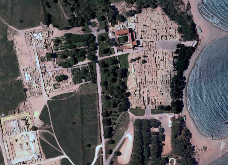 |
Ampurias. The ruins of the Greek city of Ampurias founded by the Phocaeans of Marseille. Google Earth image |
The distance between Ampurias and the Pillars of Hercules (Strait of Gibraltar) is 6,000 stades, or 950 km. Did Pytheas cover the distance in one go or did he stop at the Massaliot trading posts of Santa Paula and Maïnaké?
The strait, it is said, was jealously guarded by the Phoenicians from Cadiz. How did Pytheas get through? Some historians believe that his ship was very fast and that by sailing towards the southern part, near the coast of Africa, he would have escaped the vigilance of the Carthaginians, which would have caused him to make a large detour towards the South. For this reason, he would have taken "five days" (E14) to reach Cape Sacred (southern tip of Portugal). Others believe that the Carthaginians would have been conciliatory, but do not explain the long time it took to get to Cape Sacred.
Did Erathostene miscopy Pytheas, who otherwise gives much more accurate distances? According to Strabo, Artemidorus noticed the error. Erathostene gives 36° for the latitude of the strait. Here again, we know that he did not travel there. So it is from Pytheas that he got this information. This means that he stopped at the strait, perhaps in Cadiz. And so the Phoenicians welcomed him! We also learn that navigation up the coast of Iberia is easier than going down it (E14). Unfortunately, we do not have any text that describes the Atlantic coast of Spain. However, our explorer must have stopped there.