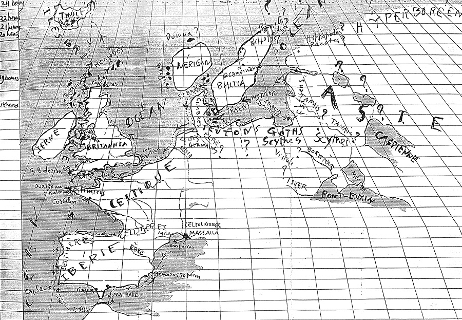
Below is the new map of Europe as we can draw it based on the information we have received.
|
Brittany is represented with two main capes as well as the island of Uxissama (Ouessant); the British Isles and Ireland; the Orkney and Shetland Islands. Above Thule as well as the frozen sea. Further to the right, the Gulf of Mituonis (Baltic Sea) with Basilea in the center. Further north, the 3 immense islands: Norway, Scandinavia and Finland. The Tanais River joins the Baltic Sea. (Map of Hecatea modified according to the discoveries of Pyrheas)
|
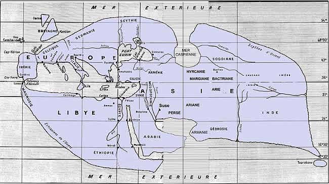
Below is Strabo's map, about 300 years later.
It is interesting to compare Strabo's map, made in Roman times. Compared to Hecataeus' map, 6 centuries later, little has changed. To the east, India is now drawn, as well as the island of Ceylon and the Ganges. The Caspian Sea now flows north and no longer east. Of course, no one went to look that way. Concerning Pytheas' voyage more specifically, we see that the British Isles are indicated (the Romans campaigned), and the general shape given by Pytheas is also there. But the "
Curvature of Europe" (Armorican peninsula) is not indicated. Strabo did not follow Pytheas for the Cassiterides Islands either. He places them north of Spain, perhaps in place of the Azores.
For Scandinavia, there is nothing
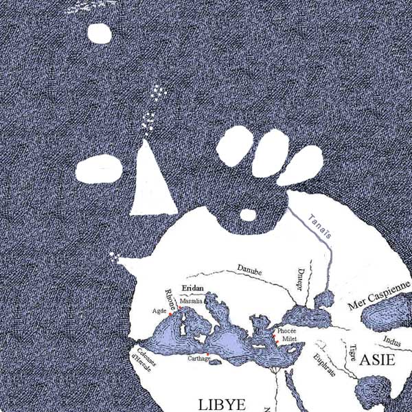
Below is the new map of Europe seen by Gaston Broche (1935)